Projecting a globe onto a flat sheet of paper creates distortions, in the usual way (cylindrical projection), the distortions are the greatest at greater latitudes. This map includes a map of the nation’s actual area as well as showing the place in degrees of latitude and longitude- essentially, it reveals the degree of distortion in the projection.

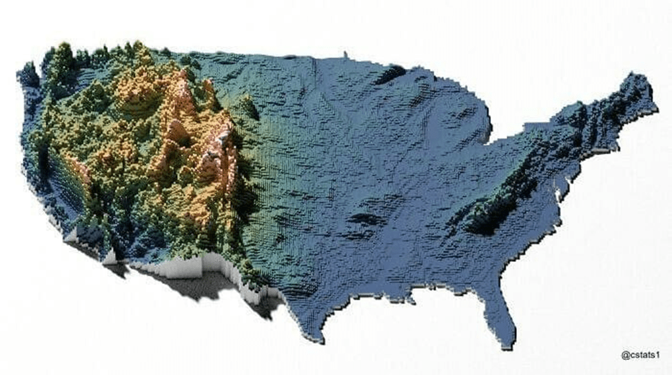
This next map gives an appreciation of how much relief there is in the west. The link to the article that includes many more maps is at the bottom – well worth clicking it and seeing more.

Leave a comment