As you look a this map of Lincoln County, drawn just after the county was carved off from Flathead, one of the first things that grabs your attention is the number of towns that existed along the Kootenai River and the railroad.
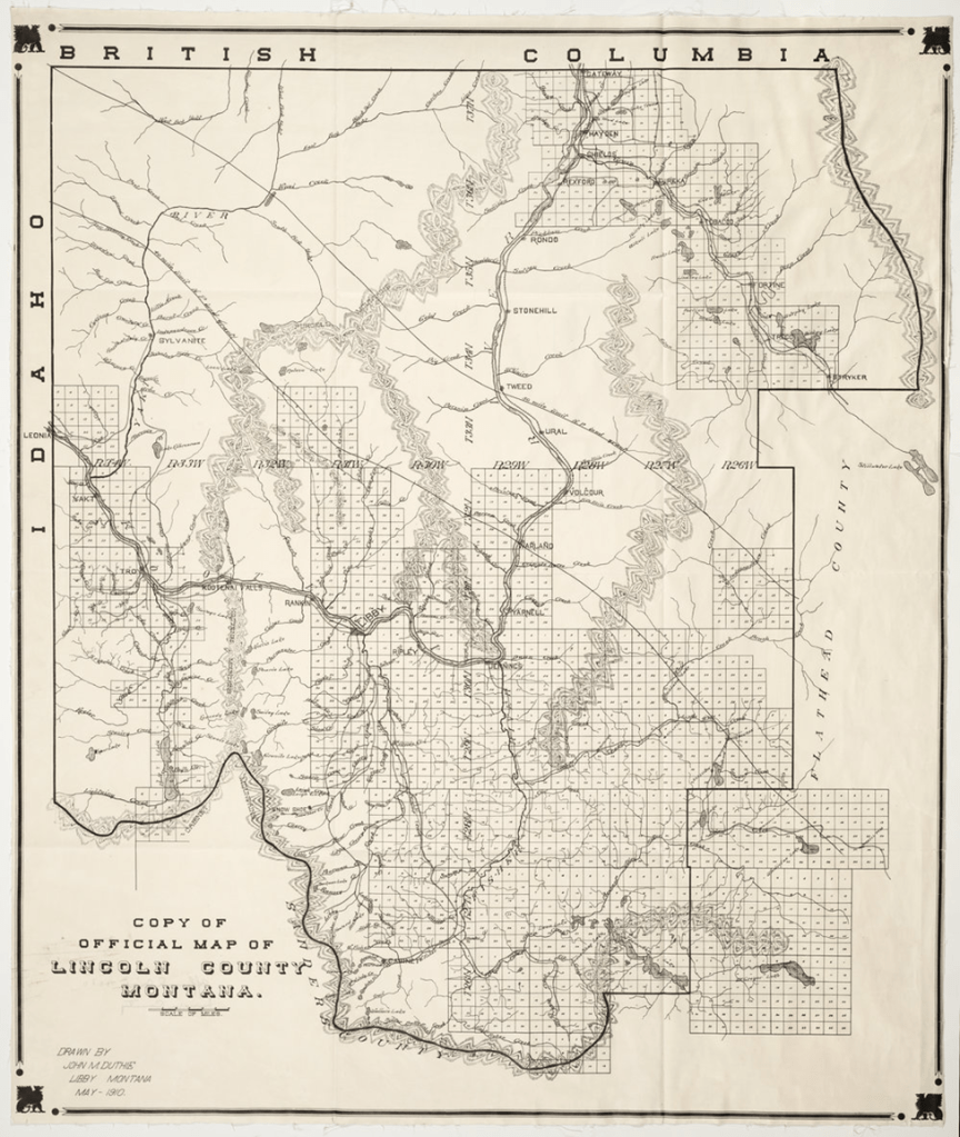
The second thing is the marked sections – the unsurveyed portions of the county were probably too remote and too rugged to be getting any homesteaders claiming land.
The third thing is that Sylvanite shows up, but not Yaak. One more point of interest is that, by the time this first county map was drawn, folks realized that Stryker, at the edge of the county, was in the Flathead drainage, not the Kootenai.
I’ll be looking for a post Koocanusa map to illustrate the communities that were lost to Libby Dam.

Leave a comment