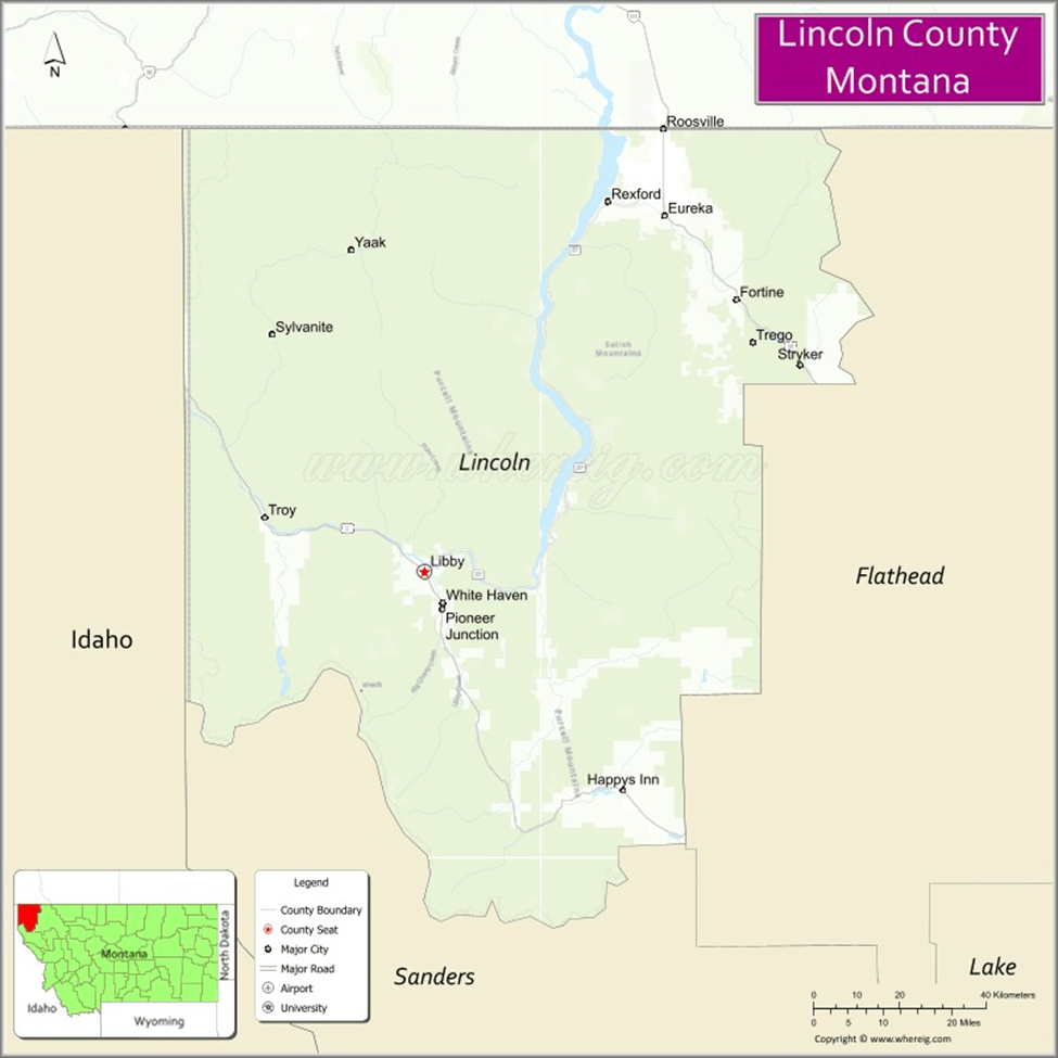
A while back, we showed the official map of Lincoln County, drawn in 1910. This week, we’re showing how the county looks after Libby Dam was completed, and the towns along the river were no more. The present map of Lincoln County looks like this one:
Water covers those old townsites between Rexford and Jennings Rapids now – there are a few taxable acres left in spots like Warland Creek, but by and large, where there were once towns and homes that maintained a continuous community, the north and south parts of Lincoln County are now connected by an empty space on the map. It’s the geographic reason why our county government is a travesty, where the residents of the north are taxed to support the courthouse clique in Libby, and the only blessing is that distance keeps us from getting as much government as we pay for.
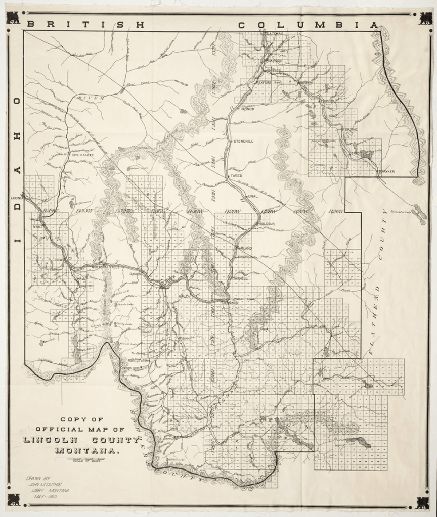
Gateway, Rondo, Stonehill, Tweed, Ural, Volcour, Warland, and Yarnell once filled those empty miles between Rexford and Libby. If I recall correctly, Laird Byers spoke of Rondo and Stonehill, Jim Kuchenski told stories about Ural from his youth, and Dave and Marylou Petersen taught in Warland before Libby Dam held the waters back and flooded those little towns.
Lincoln County was set up to be a connected community. For the last 50 years we’ve grown more into a county where the north is treated as a colony to be taxed for the benefit of the courthouse clique in Libby. The two maps illustrate the difference.


Leave a comment